

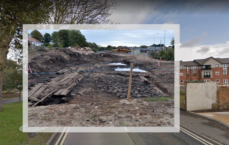
Now, this plot on a busy corner in Poulton is the site of retirement apartments. But when groundworks for them began, an old railway station and tracks, uncovered back in October 2015, made an interesting find.
The site at the junction of Breck Road and Station Road had long been derelict. It’s the plot adjacent to the traffic lights near the entrance to Wyre Council. It was when it was cleared in readiness to erect the assisted living apartments that the 100+ year old railway tracks were uncovered.
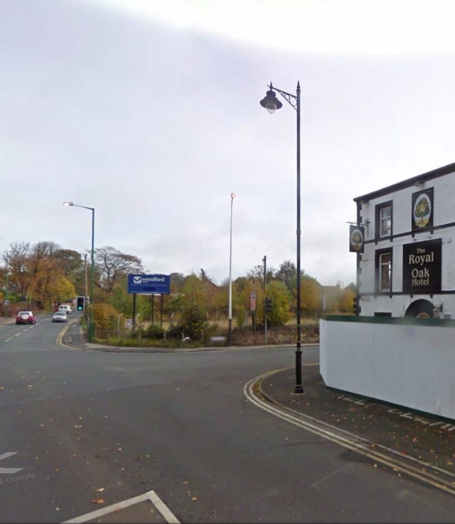
The Royal Oak has since been demolished too. More about that here.

Thanks to local rail enthusiast and Visit Fylde Coast contributor Barrie C Woods for these photos and information.
Old Railway Station and Tracks Uncovered
The site was formerly the goods yard and the original Poulton-le-Fylde railway station for the once main Poulton railway line.
FREE Newsletter
FREE Newsletter

It was closed to passengers after a serious accident in 1893. A train from Blackpool was travelling at excessive speed around a tight curve leading to the station, whereupon it derailed – with fatal results.
Poulton-le-Fylde station was later closed in 1896, when the new station opened in Breck Road. A new alignment was formed for trains to Fleetwood. It remained open for goods traffic until 1968.
The past, resting underground
Take a look at these photos of Barrie’s, showing the well preserved remains of the railway.
This photo shows a close up of the original sidings track. The vertical pieces attached to the track at the left are the remains of the buffer stop.
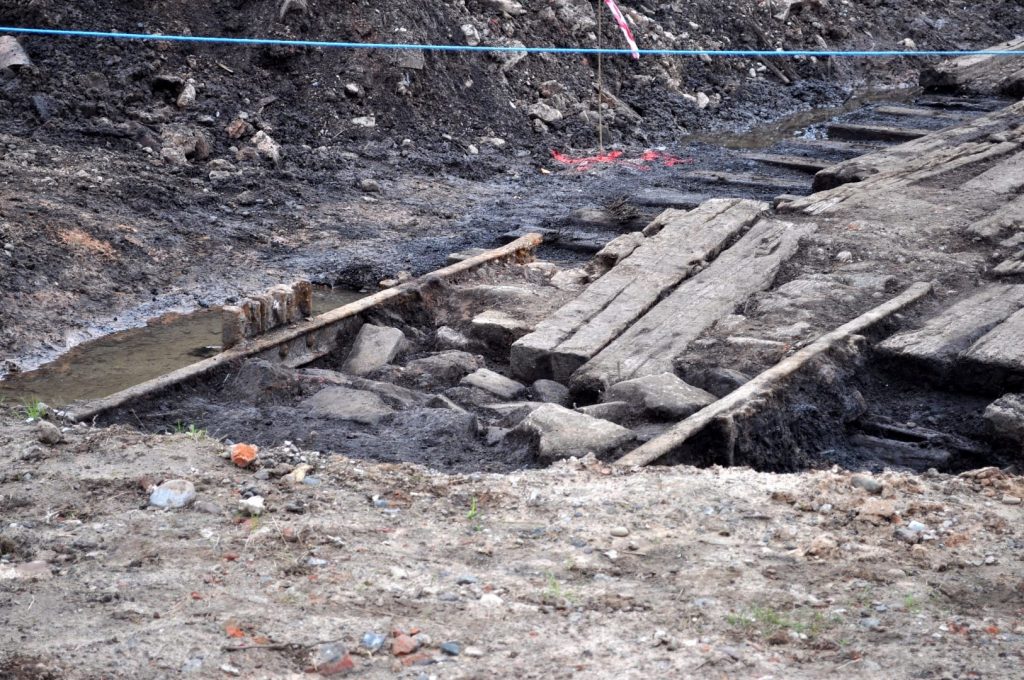
The next photo is a general view of the situation looking south-east. Note on the right some of the original stone cobbles and remains of a wall. This was most likely from a goods warehouse, or possibly a weighbridge. The station itself would have been over on the left, running parallel to the chain link fencing in front of the white railway houses
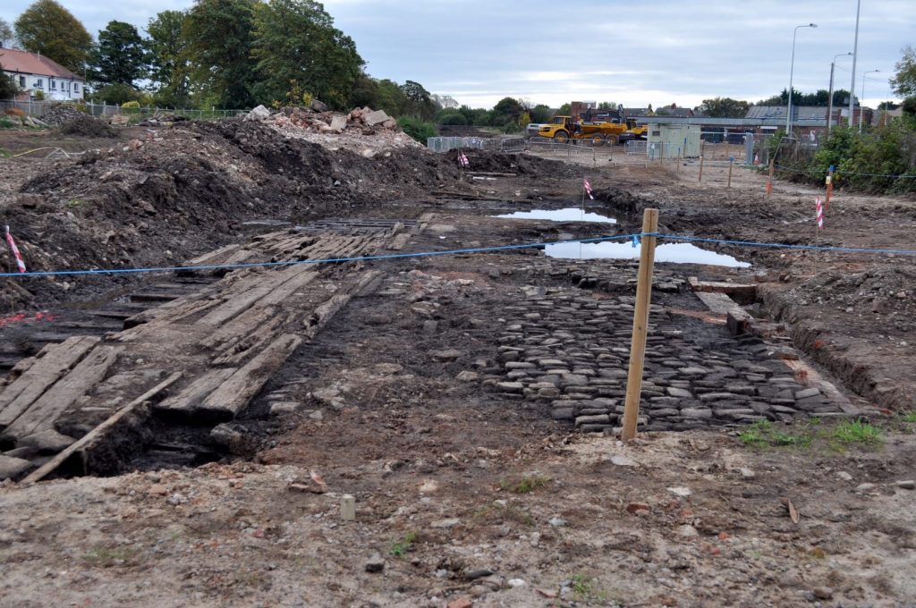
This close up shows some very ancient chairs in which the sleepers were held to the rails. The longitudinally placed sleepers in between the rails were probably added after rail traffic had finished, to make easier access for road transport.

More Memories of the Railway Line
Regular reader James Scott (sadly now deceased) added some of his own recollections of local history to this piece, saying:
“The line ran through Preston farmers corn mills. It crossed the road and ran to the old goods and coal yard which was behind the old goods and parcel office. It led to the old Fleetwood platform through an archway.
“A man stood in the road with a red flag, stopping traffic on the Breck whilst they shunted coal wagons to the coal yard. That was at the rear of the old goods station and parcel office too.
“On the right, Reg Gardner had his tinsmiths shop and on the left a Mrs Barlow had a sweet shop. I was an apprentice to Reg Gardner, until he died in the 1960s.
“A public footpath ran alongside the Parcel Office over the Golf Course to Links Gate on Tarn Road, Little Thornton.”
While you’re here…
Have a look at the homepage of the Visit Poulton-le-Fylde website for more of the latest updates.
Love the Fylde Coast? Sign up for your weekly email newsletter. Packed full of interesting things it arrives in your inbox all 52 weeks of the year.
Join us on Facebook at our Visit Fylde Coast Facebook Group
Don’t forget to follow us on Twitter @visitFyldeCoast

We Need Your Help
We Need Your Help


I grew up in Poulton and left aged 18. I returned to the Fylde coast in 2019.
My nephew has bought a house on Garratt Close, which is built on the site of the old station and goods yard. Have you got any maps that show the route of the old lines before the present station was built? We are finding it difficult to piece together how the old and the new lines fit together.
No, sorry Graham, I haven’t
hi Graham came across this thread whilst doing my own research, you can find some excellent maps on the national library of scotland website just type in old blackpool maps and google should spit it out
the line basically was dead straight it ran along the back of hodgeson school and the cricket club on moreland rd and carried straight on after the station. about 6 years after it was built they added a branch line to blackpool that came off at 90 degrees in what is now the civic centre car park